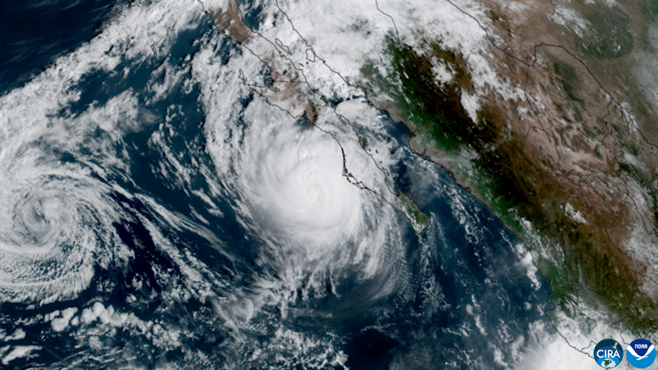
Hurricane Polo made landfall on Tuesday 29 September on the coast of Sonora, in northwestern Mexico, as a Category 1 storm on the Saffir-Simpson scale. It came ashore at around 11am local time near Guaymas; by midday the Servicio Meteorológico Nacional (SMN, Mexico's national weather service) placed the system's centre inland, some 30 kilometres east of the city, moving northeast at 28 km/h.
SMN tropical cyclone advisory number 73 recorded maximum sustained winds of 120 km/h with gusts up to 150 km/h.
Water in the middle of the port
In Guaymas the rain pooled downtown. Water rose above kerb height in several sectors, including the area around the city hall and the waterfront promenade, according to local reports gathered by La Jornada.
The Secretaría de la Defensa Nacional (Sedena, Mexico's defence ministry) activated Plan DN-III-E in the municipality — the military's protocol for assisting the civilian population — with the armed forces working alongside authorities from all three levels of government on rescue and prevention. Civil protection officials told residents to stay indoors, away from doors and windows, and not to travel while the system passed.
Authorities flagged one hazard specific to this kind of storm: the apparent calm of the eye can make people believe the worst is over, when what follows is the wind returning from the opposite direction.
What the forecast contemplates
The SMN forecast 150 to 250 mm of rain for central, southern and coastal Sonora, with intense rainfall in northern Sinaloa and heavy rain in Baja California Sur and in northern and western Chihuahua.
At sea, the official forecast pointed to waves of 4 to 5 metres in the Gulf of California and off the Sonoran coast, and of 1.5 to 2.5 metres in northern Sinaloa, with sustained coastal winds of 90 to 110 km/h.
The hurricane-force wind warning zone remained active from Bahía Kino to Huatabampito, in Sonora, and the tropical-storm wind zone from Huatabampito to Topolobampo, in Sinaloa. Alerts for Baja California Sur were discontinued.
This was Polo's second landfall: the first, in Baja California Sur, left no significant damage according to official reports. After crossing Sonora the system weakened to a tropical storm.
The figure worth watching is not the category but the rainfall total: 250 mm is the kind of volume that, over a low-lying port like Guaymas, produces urban flooding regardless of how strong the wind is.
With information from the Servicio Meteorológico Nacional (Conagua), the National Hurricane Center, La Jornada, El Imparcial, La Razón, PorEsto and EFE.